
Alternate Harvey's access
2023/08/20
I describe an alternate access to Harvey’s crag by biking from the Rotary Park trail and hiking through the conservation area.
Introduction
My friend and I usually climb at either the Bethel or Timberwolf sites in Sudbury, and we’ve haven’t strayed much to other sites due to long trips or access problems.
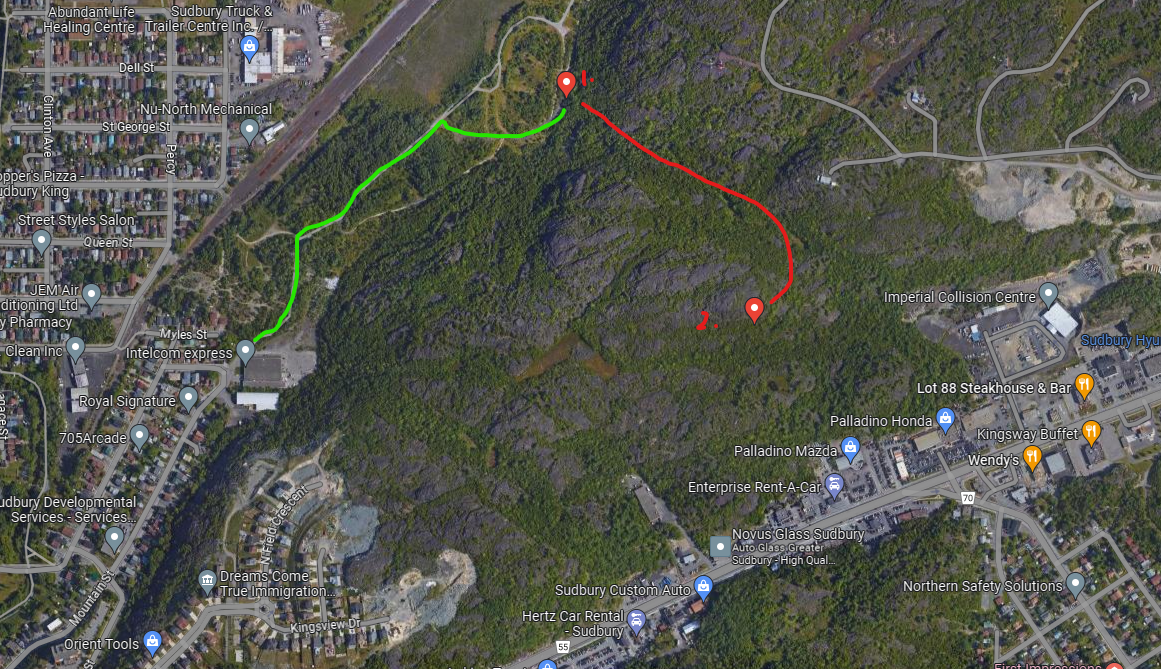
Harvey’s is a climb just off the Kingsway as documented on the Climb Sudbury’s site, here. Since the climb is in a conservation area, and a very short drive from my apartment, it seems like the perfect site. However, my partner and I’s first access attempt went unsuccessful since we couldn’t figure out a parking spot, and were uncomfortable with cutting behind the Enterprise Rent-a-Car. There were no other obvious places to park that seemed accessible other than the Kingsview Drive spot, but that was also quite a treacherous looking hike (but mostly just lengthy) if elevation maps are to be considered[^kingsview]. Also, we tried the radio tower road, but were put off by the “No Trespassing” signs that were posted.
After being frustrated by this and finishing a lot of climbs at both Bethel and Timberwolf, I really wanted to climb at Harvey’s. I noticed a few weeks back on Google Maps that the Rotary Park Bike Trail was only slightly north of where the Harvey’s climb was. In my mind, we would be able to hike from the bike trail to the climb and not have to worry about the parking.
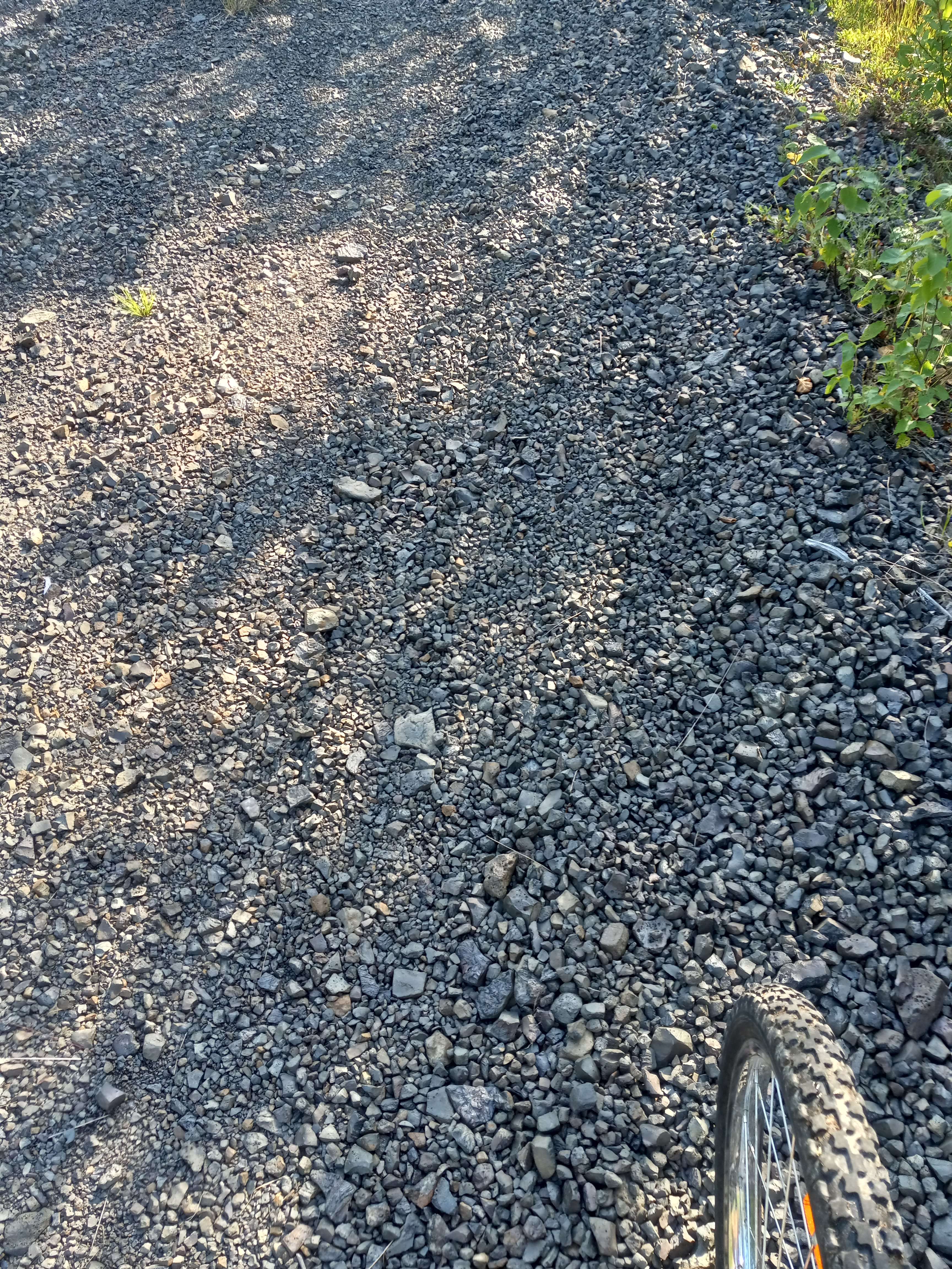
I did a test bike ride over the trail to the rough access point I imagined from consulting elevation maps. The access point was on a coarse gravel that was too rough to bike over, so for a couple hundred meters a bike would need to be pushed. The forest itself is very sparse from the trail to the hike, and there isn’t much vegetation on the ground for the main trail. There are also a lot of solid trees to lock a bike too and hide it away from.
Access
I would recommend bringing long pants and a long sleeve top, as there are a lot of mosquitoes in the forest.
From the trail entrance beside the Intelcom Express building off Mountain street, follow the trail until the second fork in the road. Take the fork off the nice fine gravel to the more coarse gravel.
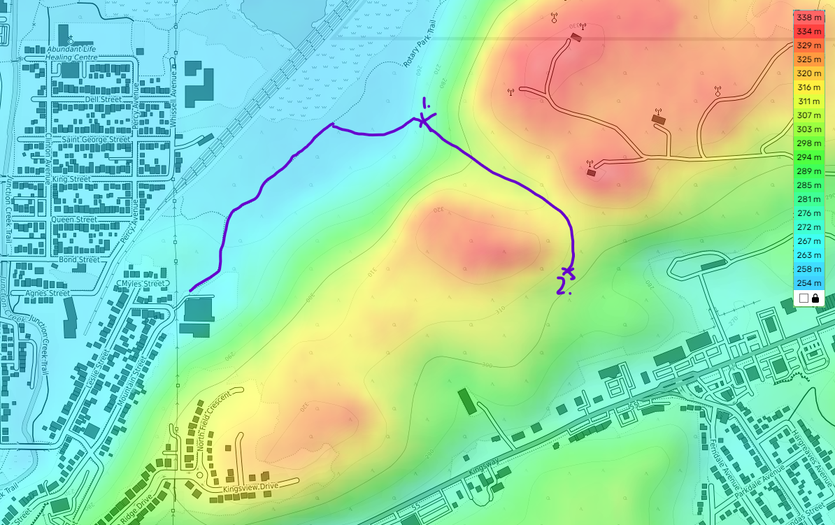
Proceed along the trail until reaching the orange flagging tape around point 1) on the maps.

You’ll want to chart a course that keeps you roughly in the valley. The hike is roughly 500m total, and you ascend about 40m over that time. Eventually, you should reach a stream, which we followed until we found pink flagging tape. Follow the flagging tape, and it should lead to black rocks around 2) that indicate the crag. We didn’t necessarily time the access, but I would estimate it’s a 5 minute ride from the trail head, and a further 15-20 minute hike.
Comments
Personally, the initial hike was not too bad. The main areas that dragged it down were:
- Finding a place to lock bikes.
- The uphill portion.
- Staying climbing too late and walking back in the dark.
These issues aside, I think this access could be a promising alternative to parking somewhere around the Kingsway and taking the beaten path. If you’re a road not taken sort of person or want to do the hike, then I would recommend giving it a try. If you know a parking spot, and are okay with cutting across the Enterprise or through the “No Trespassing” signs on the radio tower road, then disregard this access.
[^kingsview] After measuring the actual distance on a direct path to Harvey’s it would actually appear that the distance is the same as the route I’ll later describe at 500m, and it’s more flat. Who knew?